blah blah blah
Lower and Middle Hall Ponds
Length: 2.6 miles out-and-backDifficulty (click for info): Moderate
Elevation Gain: 150 feet (+110 feet on return)
Rating (click for info): 7/10
Elevation: 1382' (Lower) and 1454' (Middle)
Driving Directions:
Trailhead is on Sandwich Notch Road in Sandwich, NH. (Seasonal road - check status on TrailsNH to verify gate status). To get there, take Rt. 49 3.1 miles north of the junction with Rt. 175 and bear right uphill onto Sandwich Notch Road, which soon turns to dirt and becomes a steep and rough seasonal road. Drive 3.4 miles in on the road. After passing the white house in a clearing, look for an opening in the woods on the right, just before a bridge, where an old road begins. Park on the roadside here. Click here for a Google map.
About the Hike:
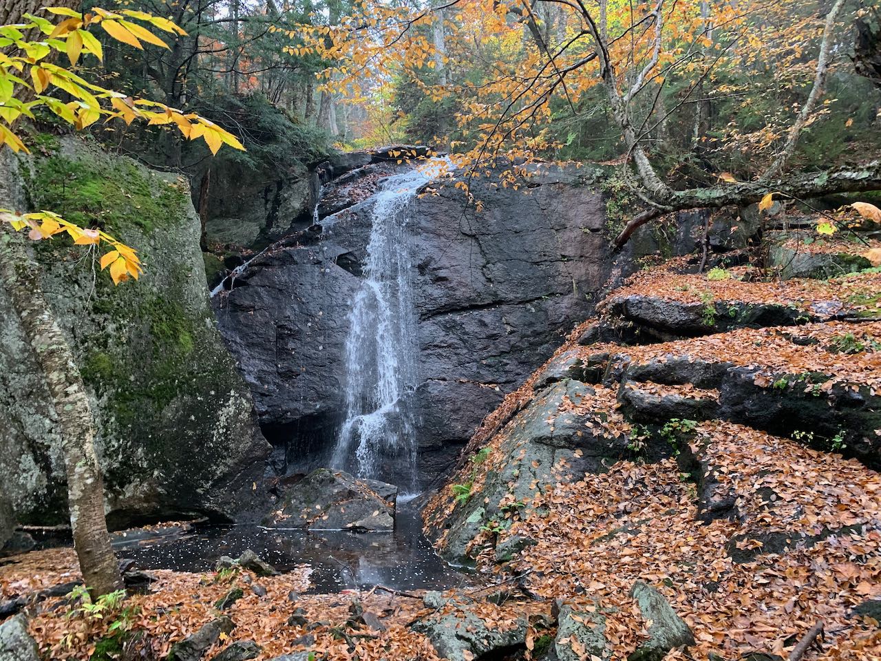
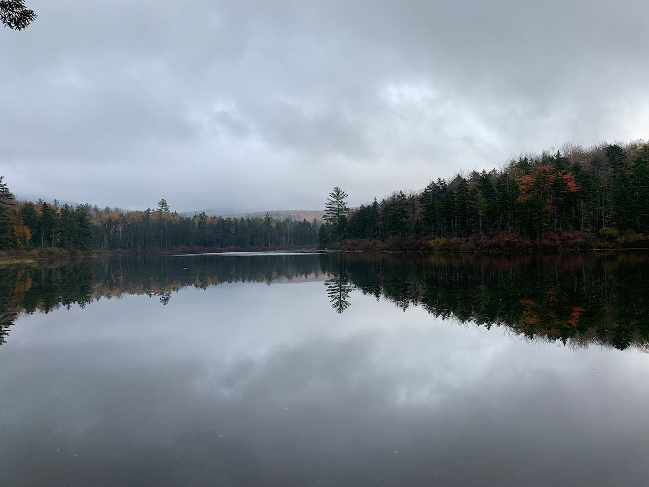
The three Hall Ponds are the scenery centerpiece of Sandwich Notch. The upper pond is complete with an access road and beach and is at least mildly popular with fishermen and picnickers. The middle and lower ponds are much more withdrawn into seclusion, and a measure of navigational effort is required to reach them. The two ponds are close enough to merit visitation of both in one trek. Both of them are networked with only obscure fishermen's paths. No service maintains the trails or provides information about them. Though an easy walk in terms of physical challenge, the hike to the ponds necessitates high navigational awareness and experience following faint and unknown trails. Bring a GPS plus a map and compass to be prepared. Finding the ponds brings about a sense of adventure and excitement from seeing scenic sites that few others can find or even know about. Both ponds are tranquil beauties to be lingered over. An added prize at the end of the journey is an impressive waterfall with no name and just as much publicity.
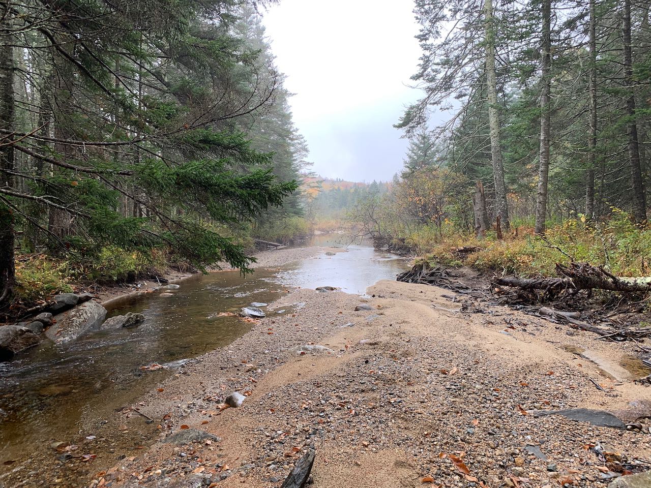
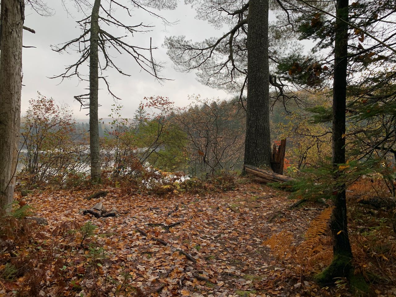
Head straight down the old road into the woods, descending slightly. Blowdowns impeding the pathway are the norm. After 0.2 miles, the trail approaches a scenic sandy spot on the brook, where you can look ahead as it converges with the marsh flowing out of the lower pond. The path swings away from the brook and leads up an often muddy section, then descends, coming near the east end of Lower Hall Pond in another 0.2 miles. At this section, where a spur path drops down to peep through the bushes at the waterside, you must pause and take care to find the correct path forward, which disappears into an overgrown patch and continues in the same direction along the pond, a distance above. In 0.2 miles, the trail comes out into a brushy section, where it crosses the small brook joining the Hall Ponds after 0.2 miles. The pathway journeys over a rolling knoll and drops into a hollow with a towering tree caonpy in another 0.1 miles. Here, the trail can be hidden by leaf litter as it turns left and exits the hollow toward the shore of the pond. In less than 0.1 miles, it comes out to a peaceful hideaway at the waterside on the west side of the pond. The water stretches out in both directions of the pond's oblong form from this point on the shore. The low hills around the notch between Mt. Weetamoo and Sandwich Dome rise over the water.
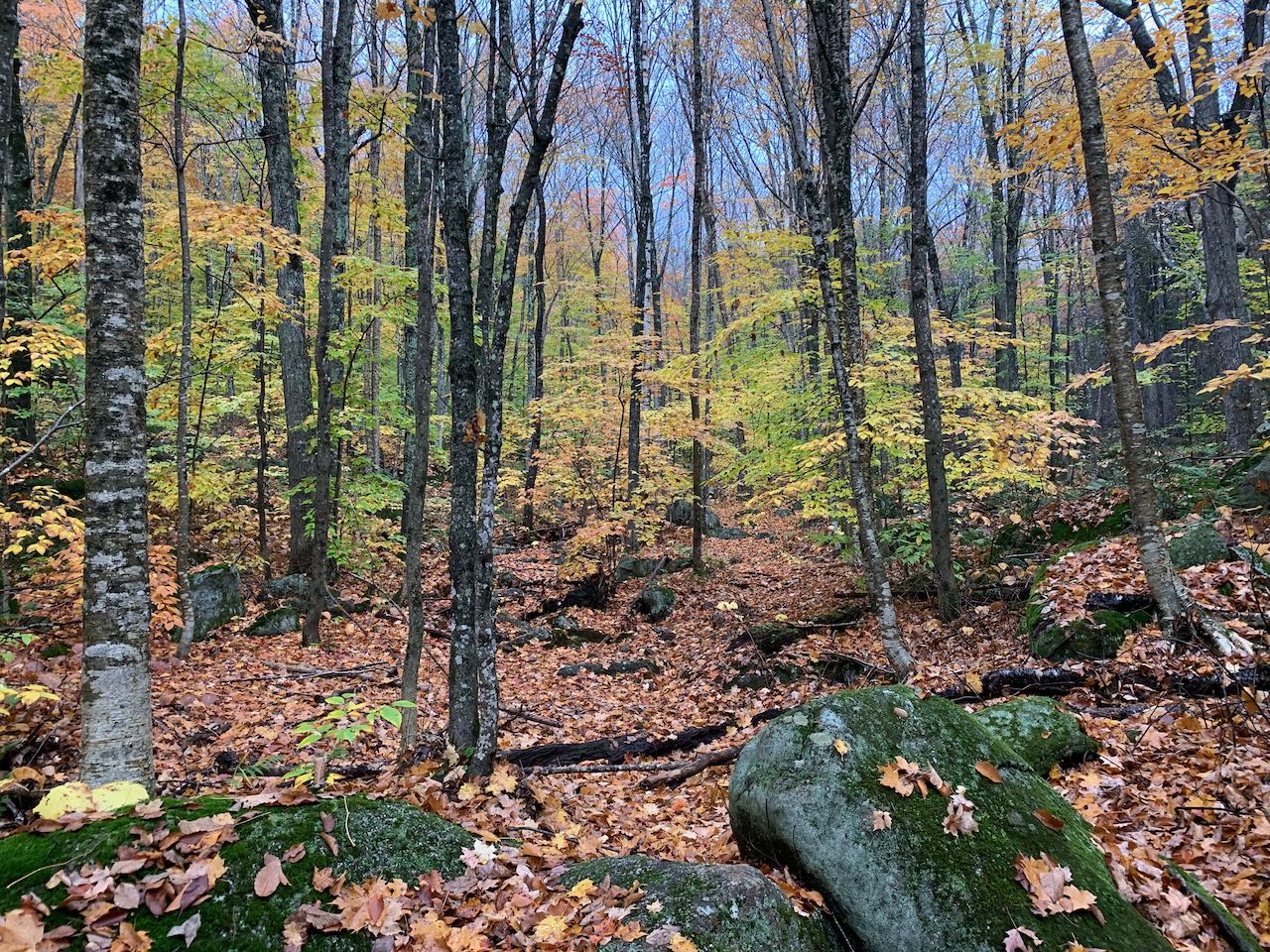
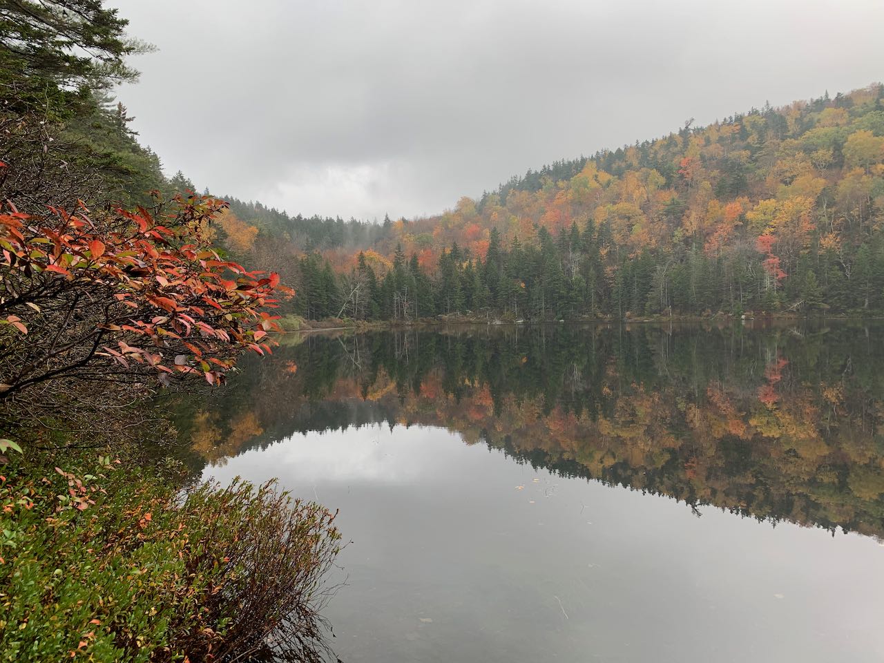
To continue on to Middle Hall Pond, turn back nearly the way you came and follow a wider footpath as it ramps up a short hill and takes you 0.1 miles out to a grassy clearing just beyond the end of a dirt road (an alternate way to access the ponds - consult a map). As a path to the left leads out to the road, turn right and follow the narrower trail back into the woods. The trail curls to the left and heads up a prominent valley, weaving back and forth across a tiny brook. Here it may be hidden in the forest floor. It passes by a sizeable mossy ledge and reaches the south end of Middle Hall Pond 0.3 miles from the clearing. This pond is much smaller in area than the lower pond, and all that can be seen from here is the forest around it, but it has a much more serene character. The path continues on the sidehill close beside the water, hobbling over roots and rocks. It crosses a trickling brook beneath an outsized waterfall over a ledge high above the trail, then reaches the inlet brook coming down from Upper Hall Pond after 0.15 miles. It didn't take much to re-orient yourself on the other end of the pond, and now you can look back across from a new perspective. Cross the brook and follow the faint path just a bit further up to its end, where you are greeted by a beautiful waterfall splashing over a tall ledge band. This waterfall is known by few, but it would be a guidebook highlight if it were located near a major road. There is space to explore around the base of the cascade, but watch out for the slippery ledges.
Printable directions page